Bidulginang Falls, Pocheon
415-2 Daehoesan-ri, Yeongbuk-myeon, Pocheon-si, Gyeonggi-doSite details
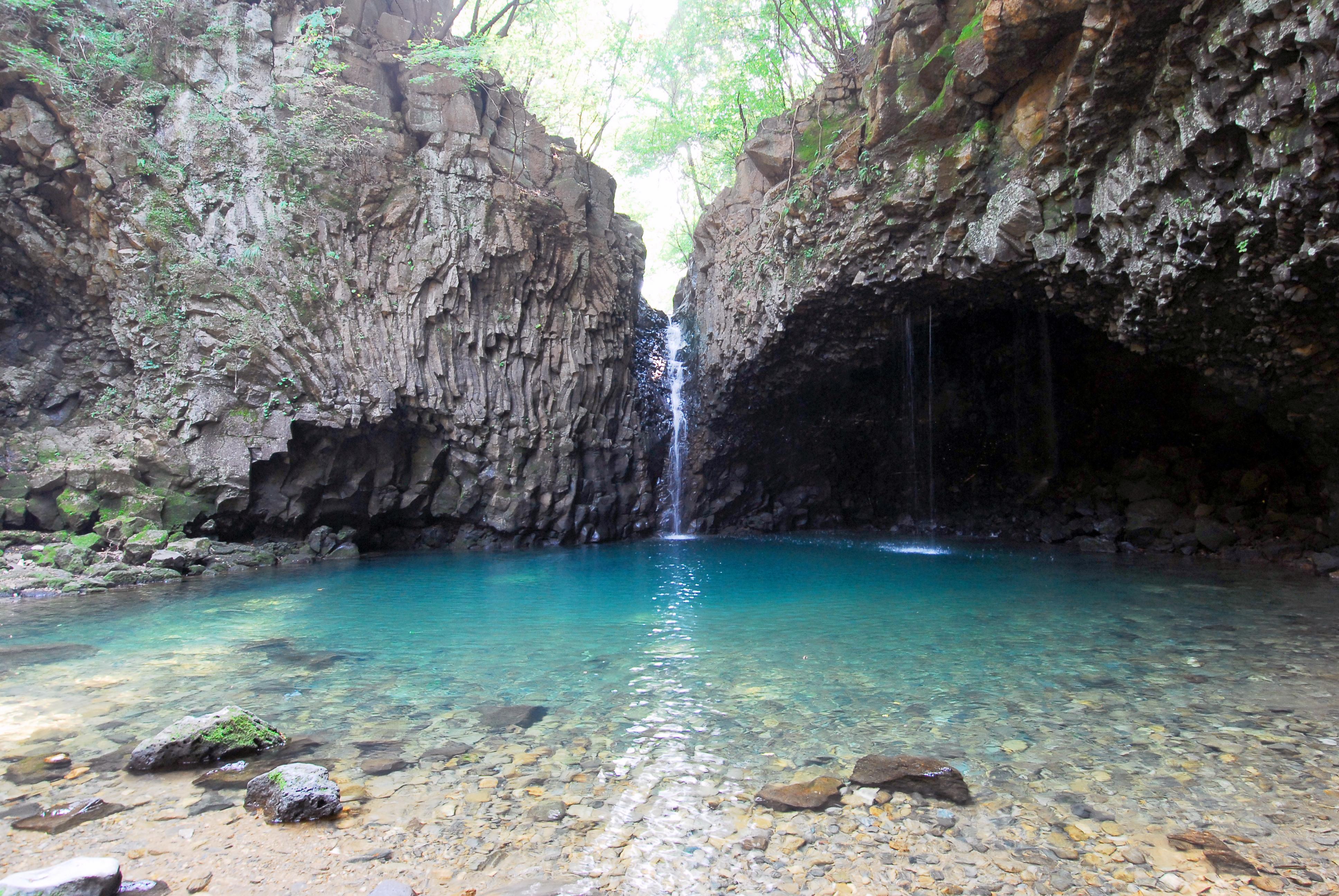
Bidulginang Waterfall, like the Pocheon Hantangang River columnar jointing gorge, was formed as the lava plateau of the Hantangang River was eroded by Bulmucheon Stream, which originates from Bulmusan Mountain. The surrounding terrain is shaped like a pouch, resembling a dove's nest, hence the name "Bidulginang" Waterfall. Another legend suggests that the name comes from the wild doves that have long inhabited the caves around the waterfall. This site, along with the Pocheon Hantangang River columnar jointing gorge, provides crucial insights into the geomorphological and geological formation processes of the Cheorwon-Yeoncheon region, with its large and small erosional caves, columnar joints, planar joints, gorges, and lava plateaus. Bidulginang Waterfall is especially significant for understanding the development of waterfalls within a lava plateau, serving as valuable data for comprehending the geomorphological and geological formation processes centered around the Hantangang River. Geologically and geomorphologically, Bidulginang Waterfall allows for the observation of various erosional landforms created by river action, including erosional caves, gorges, and headward erosion. It also reveals diverse geological structures such as columnar joints and planar joints. Additionally, the various layers of lava that flowed along the Hantangang River can be observed in a single view, making the site of great academic value. During the Korean War, the dense vegetation and its concealed location made it a shelter for local villagers and a retreat for soldiers. Today, Bidulginang Waterfall is designated as a Natural Monument in 2012, protecting its natural beauty and scenery, and it continues to attract numerous tourists.
Official information ↗